
Map Tiling Application is now available for download for just $299 USD one-time purchase
Map Tiling Application
Turn your Raster images and Vector Geographical Data into interactive Map Tiles with Map Tiling Software.
(Not a Subscription and No Annual Maintenance).

$299
Map Tiling added CAD(Computer Aided Drawing ) DWG DXFDGN Conversion to GeoJSON & GPKG
Core Features of the Application
1. Map Tiling Generator
2. Raster Conversion
3. Vector Conversion
Map Tiling Desktop App (Windows)
-
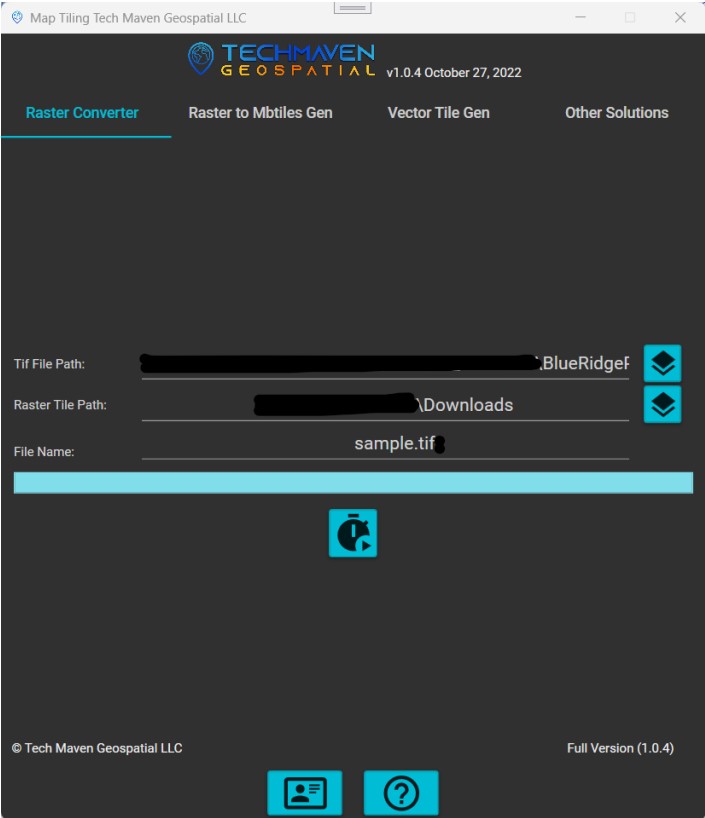
Convert Raster Formats to GeoTIFF (SID, JP2, Geospatial PDF/GeoPDF and more formats )
-
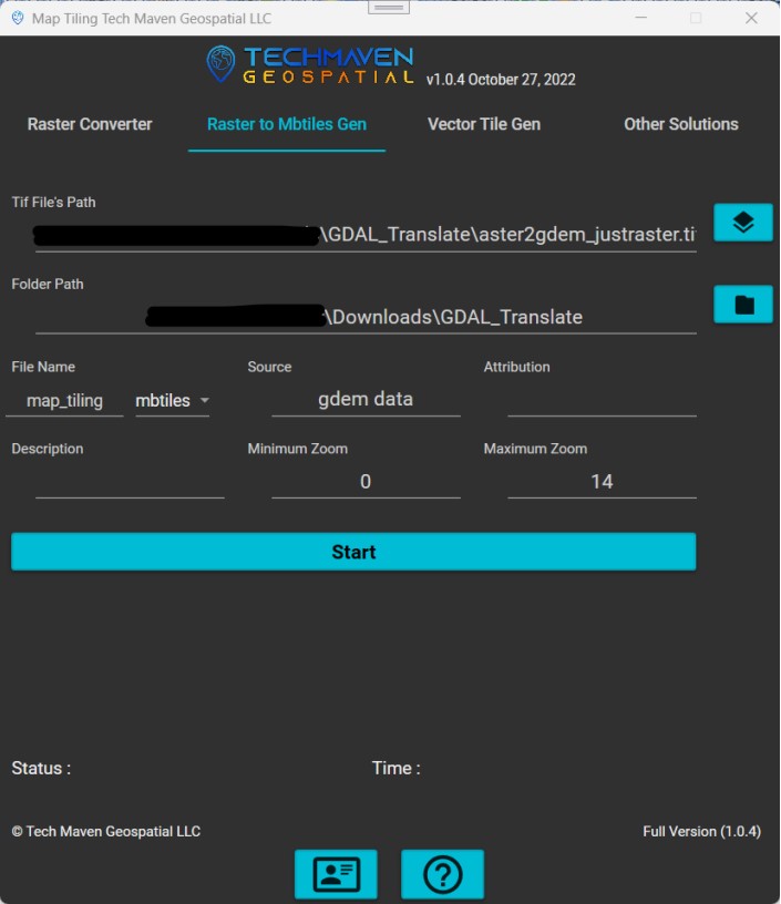
Build Raster Map Tiles from GeoTIFF and specify zoom levels and metadata (MBTILES, PMTILES, GPKG, Folder of Tiles)
-
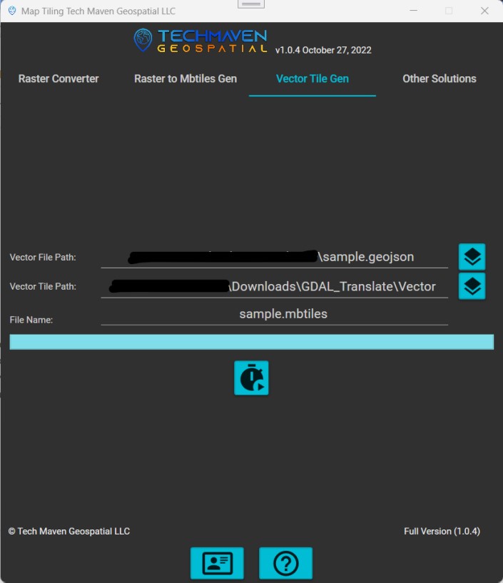
Build Vector Tiles (from GIS Vector Data KML/KMZ, GPX, Shapefile, GPKG, CSV with lat long, Filegdb, etc) – MBTILES, PMTILES, GPKG Vector Tiles following new OGC Extensions
- Convert Vector Data to GeoPackage Vector Features and FlatGeoBuf
-
Multithreaded Fast and Optimized! (Unlocked will use all resources available not sold by the number of cores and not limited by size of raster)
If you prefer command/line console apps we can sell you TIF to MBTILES dotnet 6 application.
Affordably priced at $199.99 one-time purchase (Not a yearly subscription)
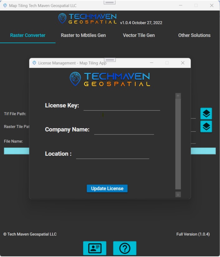
If you need a multi-pack license we also offer that you can have one license key good for N number of installs.
")
")
Map Tiling Generator
Use your Geotiff files and create map tiles, the supported output formats of map tiles are MBTiles, PMTiles, Geo Package. The process of Map Tiling Generation uses maximum CPU to make processing fast.
Features of Map Tiling Application
RASTER TILES TO TIFF
Vector Conversion
Convert your geospatial vector files into different vector tiles. You can convert any of the below mentioned supported Input File into any of the below mentioned
Supported Input Formats are;Shapefile |
Supported Output Formats areMBTiles
|

Raster Conversion (GeoPDF, JP2, SID)
Convert your GeoPDF, JP2 and SID Files into Geotiff. This conversion uses GDAL binaries.
- Supported Input Formats are; PDF, JP2; SID
- Supported Output Formats are Geotiff
")
Convert Raster imagery
(MrSID, jp2, and geospatial pdf/Geopdf, NITF/RPF – CADRG,
ACRG, ECRG, CIB, other)
into Cloud Optimized GeoTIFF files.

Vector GIS Data to Vector Tiles
Convert your vector GIS data into Mapbox Vector Tiles (MBTILES, PMTILES, GPKG Vector Tiles).
Supported Vector GIS data formats are: :
ESRI shapefile, Geopackage, Auto CAD DXF/DGN, GeoJSON, KML, Personal Geodatabase, and FileGeodatabase (more formats coming soon)

GeoTIFF to Raster Map Tiles
Build Map Tiles MBTILES and PMTILES from GeoTIFF Convert your GeoTIFFfiles into standard Mbtiles. MBTiles can be used as portable and storable mapping solutions

Compatibility
Output to multiple formats (MBTILES, GPKG, PMTILES) can be used to serve offline mapping solutions or on the web or on-premises (no internet).

Uses Maximum Cores
The Conversion of Raster tiles to tiles uses maximum CPU cores for faster conversion.

Exploring Map Tiling Application
Try Map Tiling Application
Download the trial version of Map Tiling Application

Technical Specifications
Operating Systems
- Windows 7+
- Windows Server 2008 R2 or newer
Input formats
-
Raster to Tiff
- TIFF/GeoTIFF
- MrSID
- JPEG2000/GeoJP2
- GeoPDF
Vector to MVT
- ESRI Shapefile
- GeoJSON
- GeoPackage
- KML
- DGN
- DXF
Output formats
- MBTiles
- Tiff
Desktop viewers
- Map Discovery Windows
- Earth Explorer 3D Map
- Google Earth
- ArcGIS for Desktop
- QGIS (Quantum GIS)
- Global Mapper
- uDIG
- any viewer supporting OGC WMTS
Mobile native viewers
- Google Maps SDK for iOS
- Google Maps SDK for Android
- MapLibre iOS SDK
- MapLibre Android SDK
- Apple MapKit
- RouteMe
- OSMDroid
- any viewer supporting OGC WMTS or TileJSON
Hosting
- Windows Tile Server
- Geo Data Server
- 3D Tiles Server
We’ve benchmarked the performance against QGIS Desktop, Global Mapper, Manifold, GDAL, Python packages and found our software to be faster and easier to use.
Convert your Orthophoto-Aerial and Drone Ortho Mosaic into MBTILES for serving on the web with tile server or use in an offline mapping app (D-DIL Environments)
Please check out Companion Apps by Tech Maven Geospatial
If you have a need for other formats like OGC GPKG Raster Tiles or OSMDroid SQLite or ESRI TPKX (coming soon) check out Tile Utilities app. Converts MBTILES to these formats and This windows app will also clip area of interest or export to folder of XYZ Tiles and performs other functions like merging. https://portfolio.techmaven.net/apps/tile-utilities/
Tile Server Windows – Serves cached mbtules and gpkg
Geo Data Server (Linux and Windows) – Delivers GeoServices REST API, Dynamic Vector Tiles and Serves cached raster tiles/vector tiles/elevation tiles from MBTILES and GPKG.
Offline Map Data Generator -Windows – Download Dynamic and Cached mapping services